


Top 10 Supercells
Most of the unforgettable supercells were prolific tornado producers, but a supercell doesn’t have to produce a tornado to be truly memorable.

April 29, 2009 - Garden City, Kansas: This was my first true supercell that I caught in a field just outside of Garden City, Kansas. It did produce a brief tornado, but ultimately that isn't want made this storm memorable. The pristine structure and near-zero storm motion made it a spectacle that I would remember forever.
June 17, 2023 - Beaver, Oklahoma: This storm produced at least 4-5 inch hail on the road going into Beaver, just west of town. My car survived the encounter, but I lost plenty of car parts, including the wind shield when I was hit with the 4-5 inch hail. The storm did not produce a tornado, but did exhibit exquisite structure as it moved into Fort Supply, Oklahoma.
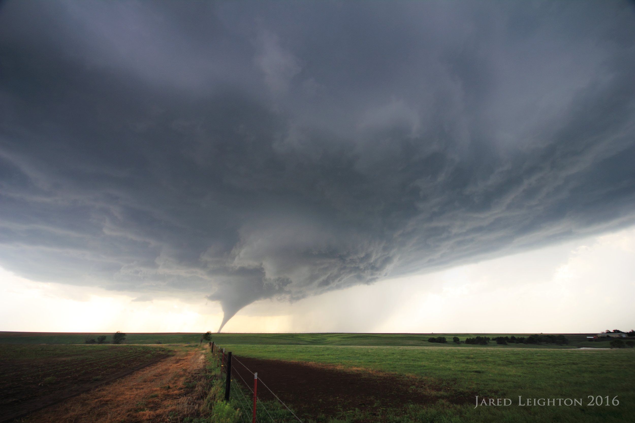
May 25, 2016 - Solomon, Kansas: This prolific tornado producer exploded just north of Interstate 70, near Salina, Kansas. This storm demonstrated perfect structure, and then went on to produce a 90-minute long violent tornado that nearly impacted Abilene and Chapman, Kansas.

May 21, 2016 - Leoti, Kansas: This supercell kicked off the most prolific week of chasing I had ever encountered. This supercell did produce a brief tornado near Leoti, but it's memorable trait was its structure and near-stationary storm motion. I sat in a field and watched it without moving for nearly two hours.
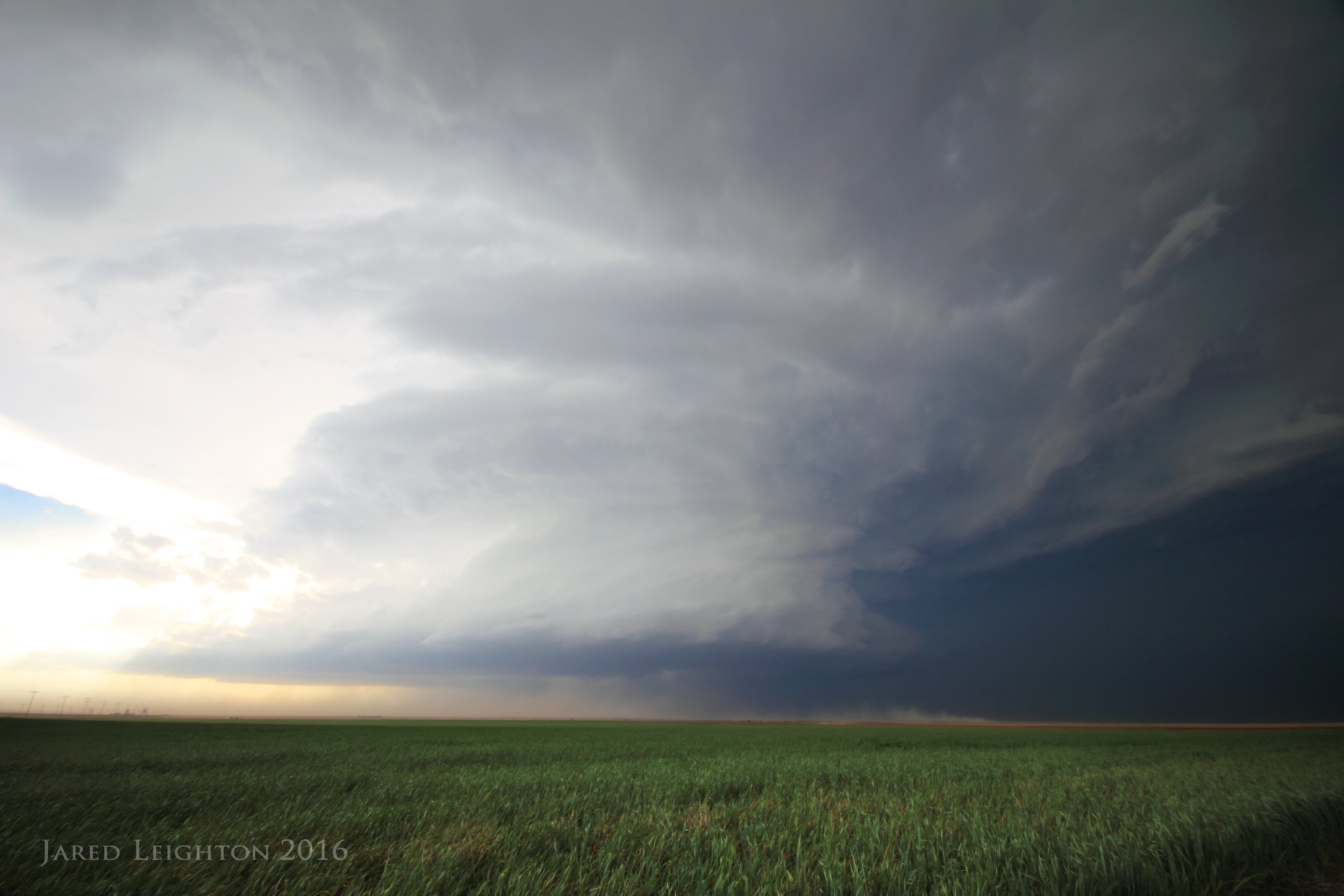
April 15, 2016 - Stratford, Texas: This was perhaps the most powerful supercell I have ever experienced. The inflow wind of this storm topped 40-50 mph, and created massive dust flows into the base of the storm. It ultimately produced a few tornadoes around dusk across the Oklahoma Panhandle, but the fierce inflow and structure are what I remember most.
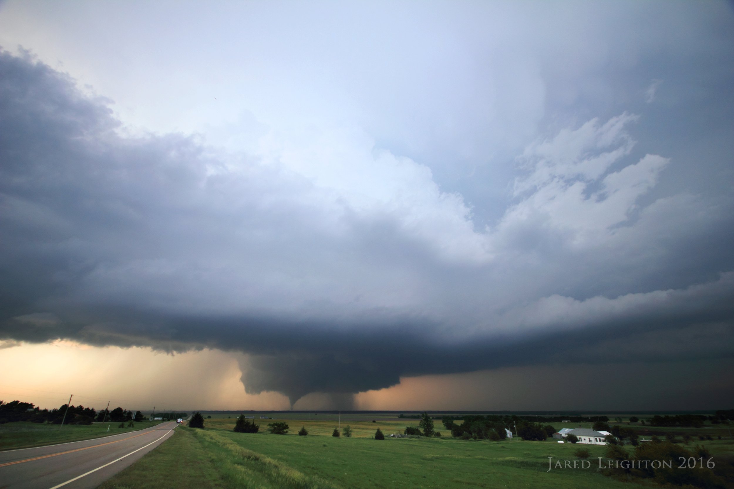
May 24, 2016 - Dodge City, Kansas: This supercell formed in an obvious location for spectacular results. The first tornado formed a few miles south of Dodge City. As the storm moved northward it rapidly formed several more tornadoes, at times simultaneously. By the time the storm ended it produced 10-15 tornadoes across the southwest Kansas countryside and swiped a path through the west side of Dodge City.
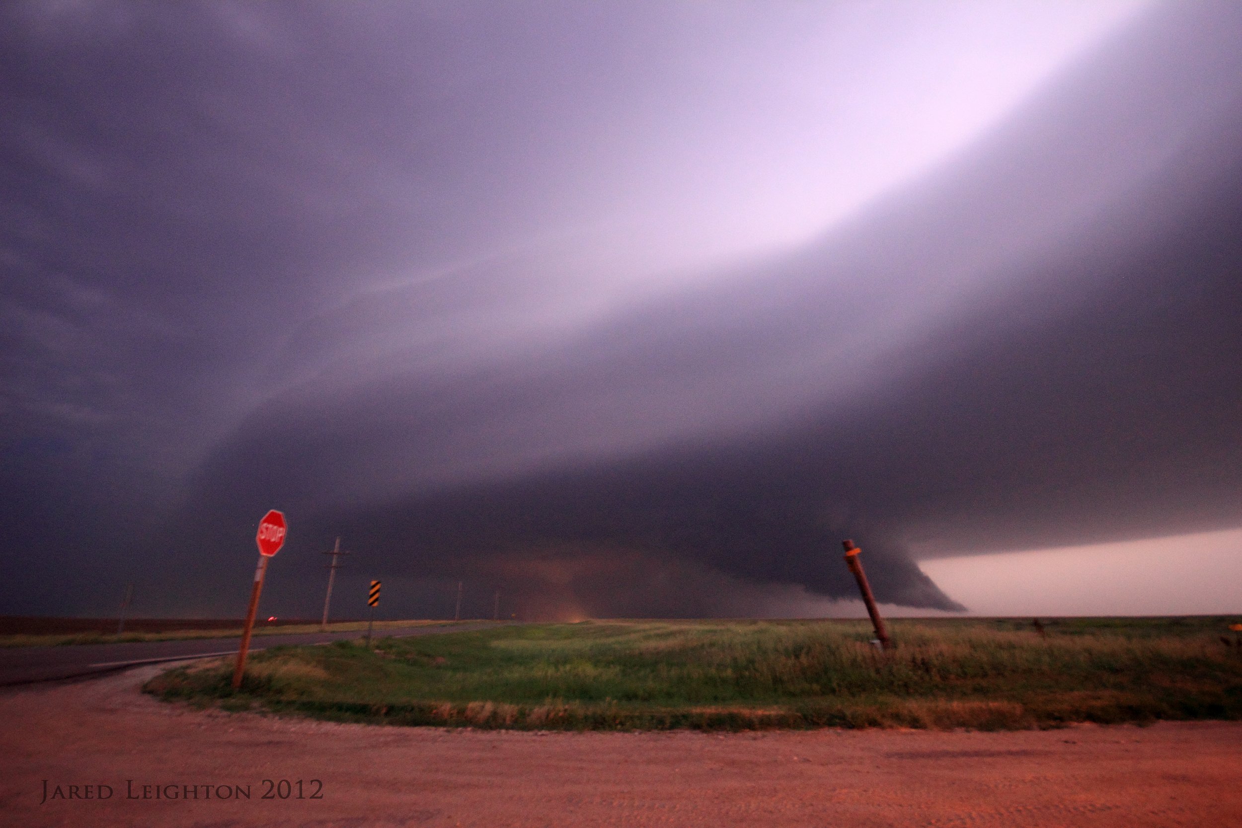
May 25, 2012 - La Crosse, Kansas: This supercell formed as the far southern storm of a string of supercells in central Kansas. It was nearly stationary for two hours before it finally produced its first tornado around dusk just west of La Crosse. This storm went on to produce numerous nocturnal tornadoes in fields across central Kansas.
May 24, 2011 - Chickasha, Oklahoma: This supercell formed a violent tornado just east of Interstate 44 in central Oklahoma. I watched the tornado as it grew from a truncated funnel to a wedge just east of Chickasha. Trying to find the best way to follow it I got stuck on Interstate 44 under the updraft, with no exits. I saw the tornado just to my east along the interstate as it tore a EF-4 path through Blanchard, Oklahoma. It eventually dissipated just north of Blanchard.
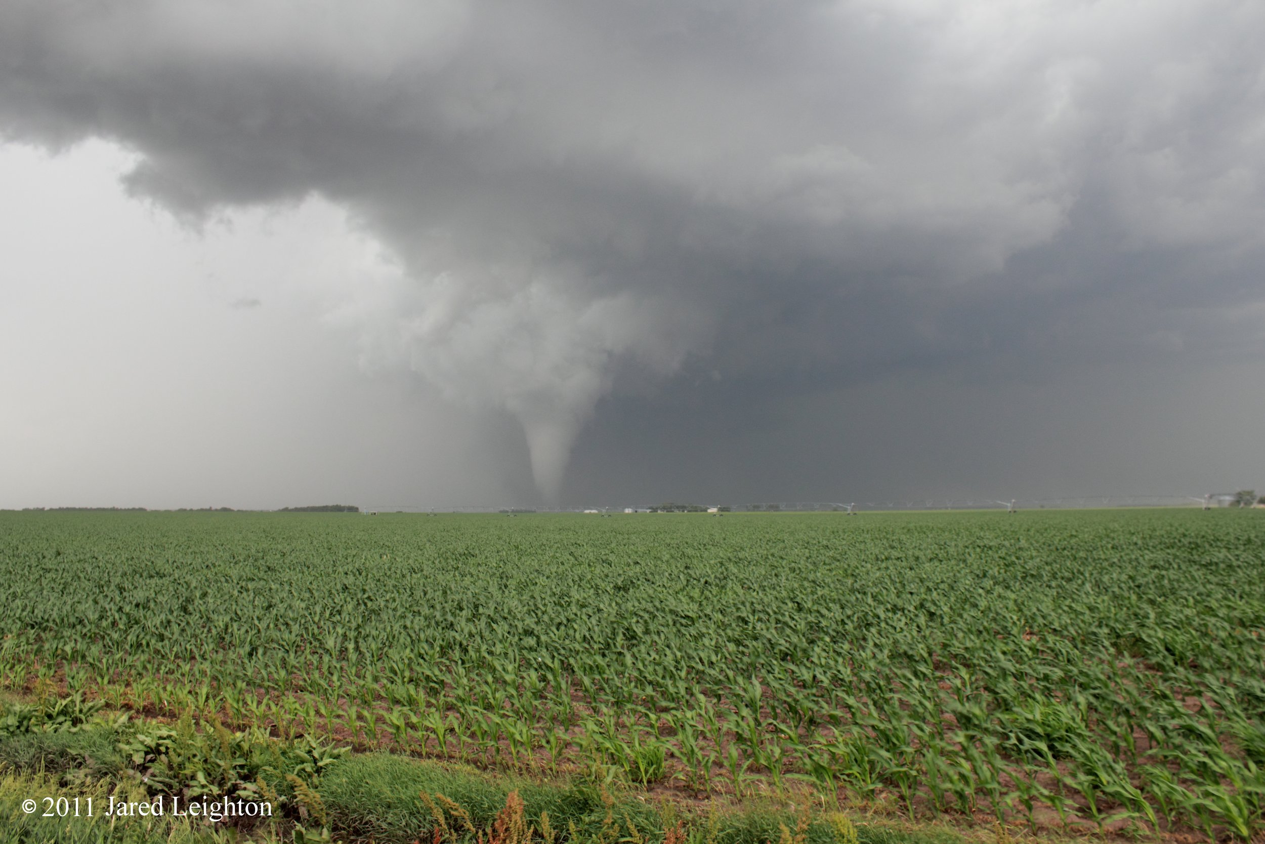
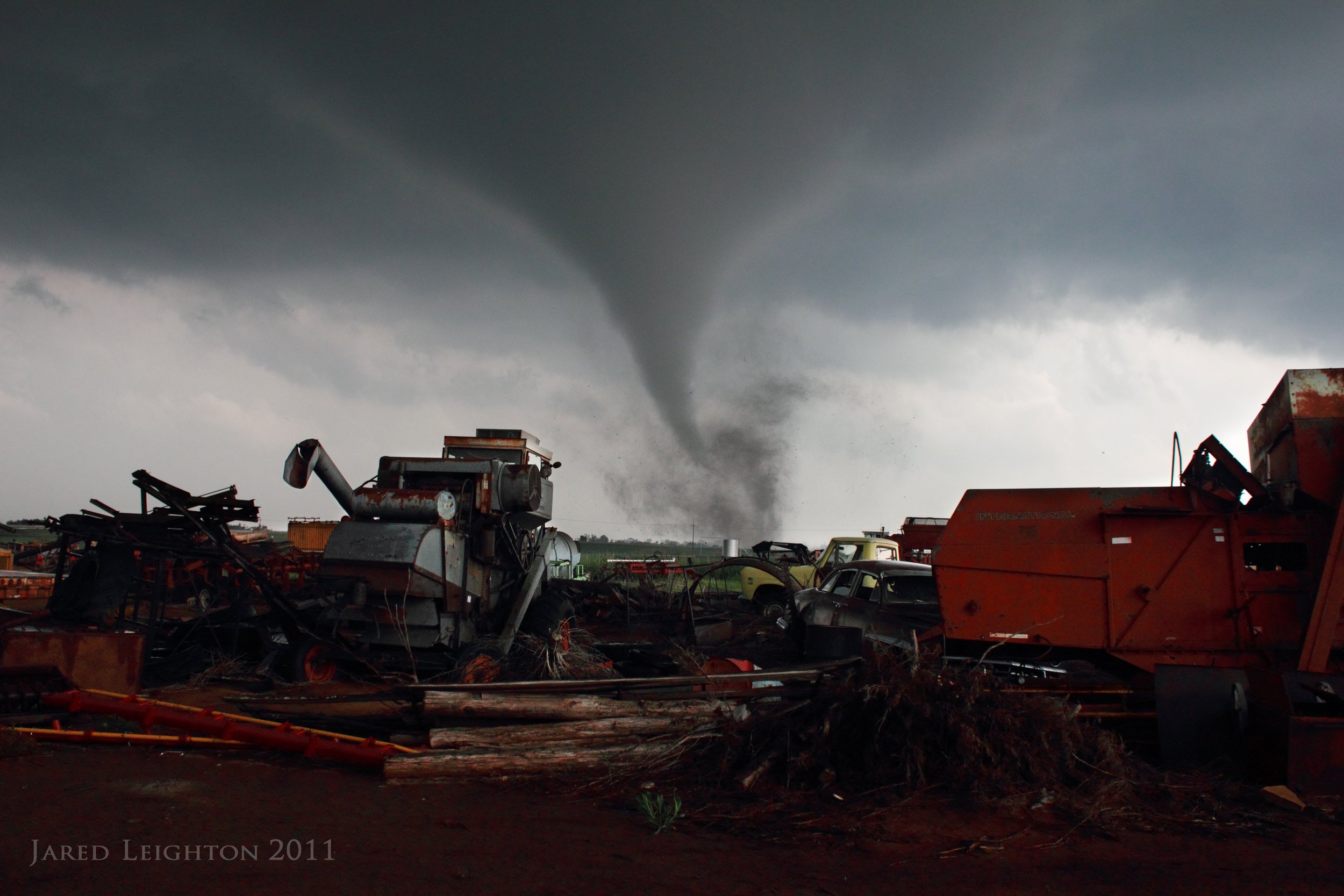
June 20, 2011 - Bradshaw, Nebraska: A late start on this day put me behind the early action. After a bit of a lull, a supercell fomed just south of Interstate 80 just west of York, Nebraska and produced a tornado before it crossed the interstate. Just north of I-80 it produced a more prolific tornado near Bradshaw, Nebraska. It went on to produce several more tornadoes north of I-80.

May 17, 2019 - McCook, Nebraska: This supercell produced numerous tornadoes between McCook, Nebraska and Cozad, Nebraska. The first was an elephant trunk tornado just west of McCook. But the best looking tornado was a tornado that formed near sunset across the Nebraska countryside.